 vesseltracker.com
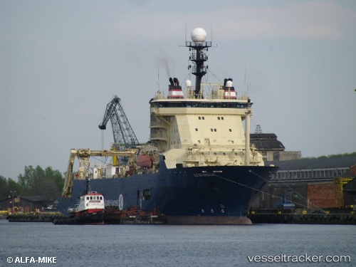
Ile De Brehat
Current StatusWhere is the vessel?
Ile De Brehat is currently in 387 nm NW of Anse Kerlan, based on AIS data received about 1h ago.
Latest AIS update:
Current position: 1.49998° N, 52.87610° E (387 nm NW of Anse Kerlan)
Average speed (last 7 days): Loading…
Average speed (last 30 days): Loading…
Vessel profile: Ile De Brehat is a Cable Layer with dimensions 23m x 140m.
This page combines live AIS, route history, probable destination signals, nearby traffic, and port activity for practical vessel monitoring.
The current position of vessel Ile De Brehat is 1.49998 lat / 52.87610 lng. Updated: 2026-04-18 15:58:22 UTCNearest reference points:
- Open sea, approx. 400 nm off the nearest listed port
- Open sea, approx. 402 nm off the nearest listed port
- Open sea, approx. 410 nm off the nearest listed port
Details:
Live Vessel Ile De Brehat Analytics (details, animations, etc.)
Recent AIS points (UTC):
2026-04-18 09:54:07 UTC · 1.07882, 52.45019 · SOG 6.1 kn · COG 33°2026-04-18 12:12:03 UTC · 1.26198, 52.58370 · SOG 5.4 kn · COG 51°
2026-04-18 13:35:19 UTC · 1.35670, 52.68559 · SOG 6.2 kn · COG 43°
2026-04-18 15:58:22 UTC · 1.49998, 52.87610 · SOG 6.2 kn · COG 54°