 vesseltracker.com
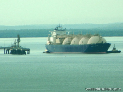
Pacific Notus
Current StatusWhere is the vessel?
Pacific Notus is currently in Near Chibai, based on AIS data received about 1h ago.
Latest AIS update:
Current position: 35.47279° N, 139.96513° E (Near Chibai)
Average speed (last 7 days): Loading…
Average speed (last 30 days): Loading…
Vessel profile: Pacific Notus is a Lng Tanker with dimensions 46m x 293m.
This page combines live AIS, route history, probable destination signals, nearby traffic, and port activity for practical vessel monitoring.
The current position of vessel Pacific Notus is 35.47279 lat / 139.96513 lng. Updated: 2026-04-22 00:17:40 UTCNearest reference points:
- Near ANEGASAKI
- Near Aomi
- Near Kawasaki
Details:
Live Vessel Pacific Notus Analytics (details, animations, etc.)
Recent AIS points (UTC):
2026-04-21 20:17:40 UTC · 35.47278, 139.96512 · SOG 0 kn · COG 145°2026-04-21 21:50:40 UTC · 35.47277, 139.96513 · SOG 0 kn · COG 145°
2026-04-21 22:38:40 UTC · 35.47276, 139.96510 · SOG 0 kn · COG 145°
2026-04-22 00:17:40 UTC · 35.47279, 139.96513 · SOG 0 kn · COG 145°