 vesseltracker.com
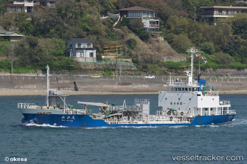
 Aki Maru
Current Status
Where is the vessel?
Aki Maru is currently in Near Hiroshima, based on AIS data received about 1h ago.
Latest AIS update:
Current position: 34.31750° N, 132.48340° E (Near Hiroshima)
Average speed (last 7 days): Loading…
Average speed (last 30 days): Loading…
Vessel profile: Aki Maru is a Cement Carrier with dimensions 69m x 12m.
This page combines live AIS, route history, probable destination signals, nearby traffic, and port activity for practical vessel monitoring.
The current position of vessel Aki Maru is 34.31750 lat / 132.48340 lng. Updated: 2026-03-30 07:27:11 UTCNearest reference points:
- Near Hiroshima
- Near Kure
- Near TSUWAJI
Currently sailing under the flag of Japan ![]()
Aki Maru built in 2001 year
Deadweight:
1745 tDetails:
Live Vessel Aki Maru Analytics (details, animations, etc.)
Recent AIS points (UTC):
2026-03-30 02:34:19 UTC · 34.04286, 132.58485 · SOG 12.1 kn · COG 275°2026-03-30 04:05:29 UTC · 34.20903, 132.50340 · SOG 11.4 kn · COG 18°
2026-03-30 05:31:30 UTC · 34.33478, 132.49818 · SOG 0 kn · COG 28°
2026-03-30 07:27:11 UTC · 34.31750, 132.48340 · SOG 0.1 kn · COG 129°