 vesseltracker.com
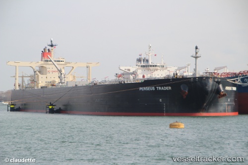
New Dynasty
Current StatusWhere is the vessel?
New Dynasty is currently in Near Basrah Oil Terminal, based on AIS data received less than 1h ago.
Latest AIS update:
Current position: 29.60730° N, 48.77910° E (Near Basrah Oil Terminal)
Average speed (last 7 days): Loading…
Average speed (last 30 days): Loading…
Vessel profile: New Dynasty is a Crude Oil Tanker with dimensions 60m x 333m.
This page combines live AIS, route history, probable destination signals, nearby traffic, and port activity for practical vessel monitoring.
The current position of vessel New Dynasty is 29.60730 lat / 48.77910 lng. Updated: 2026-04-21 05:56:56 UTCNearest reference points:
- 11 nm SW of Basrah Oil Terminal
- 15 nm S of Imam Khomeini Pt/ Mahshahr City
- 25 nm W of Soroosh (Cyrus) Terminal
Details:
Live Vessel New Dynasty Analytics (details, animations, etc.)
Recent AIS points (UTC):
2026-04-21 02:34:54 UTC · 29.60683, 48.77882 · SOG 0.1 kn · COG 322°2026-04-21 04:17:21 UTC · 29.60690, 48.77907 · SOG 0.1 kn · COG 317°
2026-04-21 04:31:19 UTC · 29.60871, 48.77895 · SOG 0 kn · COG 270°
2026-04-21 05:56:56 UTC · 29.60730, 48.77910 · SOG 0 kn · COG 307°