 vesseltracker.com
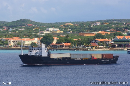
Dona Luisa I
Current StatusWhere is the vessel?
Dona Luisa I is currently in 93 nm N of Palm Beach, based on AIS data received about 1h ago.
Latest AIS update:
Current position: 14.10833° N, 70.08667° W (93 nm N of Palm Beach)
Average speed (last 7 days): Loading…
Average speed (last 30 days): Loading…
Vessel profile: Dona Luisa I is a General Cargo Ship with dimensions 14m x 58m.
This page combines live AIS, route history, probable destination signals, nearby traffic, and port activity for practical vessel monitoring.
The current position of vessel Dona Luisa I is 14.10833 lat / -70.08667 lng. Updated: 2026-04-12 20:46:08 UTCNearest reference points:
- 24 nm NW of Palm Beach
- 148 nm N of Dorp Rincón
- Near Bullenbaai
Details:
Live Vessel Dona Luisa I Analytics (details, animations, etc.)
Recent AIS points (UTC):
2026-04-12 16:21:59 UTC · 14.85293, -70.06568 · SOG 10.2 kn · COG 174°2026-04-12 18:08:28 UTC · 14.54831, -70.08021 · SOG 10.1 kn · COG 175°
2026-04-12 19:43:09 UTC · 14.28333, -70.08500 · SOG 10 kn · COG -1°
2026-04-12 20:46:08 UTC · 14.10833, -70.08667 · SOG 9 kn · COG -1°