 vesseltracker.com
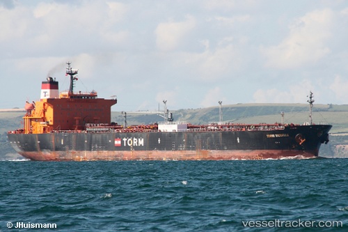
 DUKE II
Current Status
Where is the vessel?
DUKE II is currently in 28 nm NW of ALDERNEY, based on AIS data received less than 1h ago.
Latest AIS update:
Current position: 50.00479° N, 2.78222° W (28 nm NW of ALDERNEY)
Average speed (last 7 days): Loading…
Average speed (last 30 days): Loading…
Vessel profile: DUKE II is a Crude Oil Tanker with dimensions 33m x 183m.
This page combines live AIS, route history, probable destination signals, nearby traffic, and port activity for practical vessel monitoring.
The current position of vessel DUKE II is 50.00479 lat / -2.78222 lng. Updated: 2026-04-19 09:58:00 UTCNearest reference points:
- 23 nm NW of Saint Sampson
- 16 nm SE of Brixham
- Near Saint Sampson
Currently sailing under the flag of Panama ![]()
DUKE II built in 2003 year
Deadweight:
47024 tDetails:
Live Vessel DUKE II Analytics (details, animations, etc.)
Recent AIS points (UTC):
2026-04-19 03:47:15 UTC · 50.29780, -0.97498 · SOG 15.8 kn · COG -1°2026-04-19 06:21:39 UTC · 50.15835, -1.88835 · SOG 11.4 kn · COG -1°
2026-04-19 08:13:31 UTC · 50.08793, -2.35645 · SOG 9.3 kn · COG -1°
2026-04-19 09:58:00 UTC · 50.00479, -2.78222 · SOG 11 kn · COG -1°