 Pacific Islander 2
Current Status
Where is the vessel?
Pacific Islander 2 is currently in Near Honiara, based on AIS data received about 14h ago.
Latest AIS update:
Current position: 9.41916° S, 159.98433° E (Near Honiara)
Average speed (last 7 days): Loading…
Average speed (last 30 days): Loading…
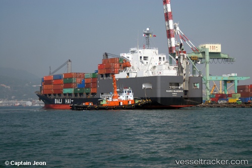
Vessel profile: Pacific Islander 2 is a General Cargo Ship with dimensions 161m x 25m.
This page combines live AIS, route history, probable destination signals, nearby traffic, and port activity for practical vessel monitoring.
The current position of vessel Pacific Islander 2 is -9.41916 lat / 159.98433 lng. Updated: 2026-05-23 19:03:51 UTCNearest reference points:
- 36 nm W of Selwyn Bay
- 38 nm SW of Selwyn Bay
Currently sailing under the flag of Japan ![]()
Pacific Islander 2 built in 2003 year
Deadweight:
17916 tDetails:
Live Vessel Pacific Islander 2 Analytics (details, animations, etc.)
Recent AIS points (UTC):
2026-05-23 13:51:50 UTC · -9.41894, 159.98611 · SOG 0 kn · COG 222°2026-05-23 16:15:47 UTC · -9.42022, 159.98409 · SOG 0.1 kn · COG 76°
2026-05-23 17:24:47 UTC · -9.42024, 159.98409 · SOG 0 kn · COG 75°
2026-05-23 19:03:51 UTC · -9.41916, 159.98433 · SOG 0.1 kn · COG 127°