 vesseltracker.com
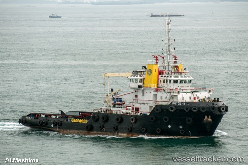
 Britoil 41
Current Status
Where is the vessel?
Britoil 41 is currently in Near KHALIFA, based on AIS data received about 2h ago.
Latest AIS update:
Current position: 24.79901° N, 54.65295° E (Near KHALIFA)
Average speed (last 7 days): Loading…
Average speed (last 30 days): Loading…
Vessel profile: Britoil 41 is a Offshore Tug Supply Ship with dimensions 60m x 18m.
This page combines live AIS, route history, probable destination signals, nearby traffic, and port activity for practical vessel monitoring.
The current position of vessel Britoil 41 is 24.79901 lat / 54.65295 lng. Updated: 2026-04-21 13:49:38 UTCNearest reference points:
- Near KHALIFA
- 16 nm NW of Jebel Ali
- 12 nm NW of Jebel Ali
Currently sailing under the flag of Singapore ![]()
Details:
Live Vessel Britoil 41 Analytics (details, animations, etc.)
Recent AIS points (UTC):
2026-04-21 10:03:54 UTC · 24.79904, 54.65294 · SOG 0 kn · COG -1°2026-04-21 11:58:57 UTC · 24.79910, 54.65292 · SOG 0 kn · COG -1°
2026-04-21 13:45:38 UTC · 24.79904, 54.65295 · SOG 0 kn · COG -1°
2026-04-21 13:49:38 UTC · 24.79901, 54.65295 · SOG 0 kn · COG -1°