 vesseltracker.com
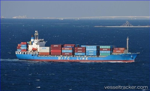
 BENITA
Current Status
Where is the vessel?
BENITA is currently in Near Mundra, based on AIS data received less than 1h ago.
Latest AIS update:
Current position: 22.64304° N, 69.72737° E (Near Mundra)
Average speed (last 7 days): Loading…
Average speed (last 30 days): Loading…
Vessel profile: BENITA is a Container Ship with dimensions m x m.
This page combines live AIS, route history, probable destination signals, nearby traffic, and port activity for practical vessel monitoring.
The current position of vessel BENITA is 22.64304 lat / 69.72737 lng. Updated: 2026-04-17 04:20:31 UTCNearest reference points:
- Near Mundra
- Near SIKKA
- Near Sika
Currently sailing under the flag of Saint Kitts and Nevis ![]()
Details:
Live Vessel BENITA Analytics (details, animations, etc.)
Recent AIS points (UTC):
2026-04-16 22:08:28 UTC · 22.64204, 69.72361 · SOG 0 kn · COG 83°2026-04-17 00:08:30 UTC · 22.64196, 69.72349 · SOG 0.1 kn · COG 69°
2026-04-17 01:29:29 UTC · 22.64201, 69.72362 · SOG 0 kn · COG 58°
2026-04-17 04:20:31 UTC · 22.64304, 69.72737 · SOG 0 kn · COG 250°