 vesseltracker.com
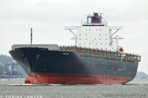
 Venetiko
Current Status
Where is the vessel?
Venetiko is currently in Near HOOKSIEL, based on AIS data received less than 1h ago.
Latest AIS update:
Current position: 53.58975° N, 8.15438° E (Near HOOKSIEL)
Average speed (last 7 days): Loading…
Average speed (last 30 days): Loading…
Vessel profile: Venetiko is a Container Ship with dimensions 280m x 280m.
This page combines live AIS, route history, probable destination signals, nearby traffic, and port activity for practical vessel monitoring.
The current position of vessel Venetiko is 53.58975 lat / 8.15438 lng. Updated: 2026-04-06 12:07:05 UTCNearest reference points:
- Near Wilhelmshaven
- Near HOOKSIEL
- Near Horumersiel
Currently sailing under the flag of Liberia ![]()
Venetiko built in 2003 year
Deadweight:
67009 tDetails:
Live Vessel Venetiko Analytics (details, animations, etc.)
Recent AIS points (UTC):
2026-04-06 05:26:30 UTC · 53.58972, 8.15438 · SOG 0 kn · COG 167°2026-04-06 07:55:50 UTC · 53.58970, 8.15442 · SOG 0 kn · COG 167°
2026-04-06 10:04:47 UTC · 53.58978, 8.15443 · SOG 0 kn · COG 167°
2026-04-06 12:07:05 UTC · 53.58975, 8.15438 · SOG 0 kn · COG -1°