 vesseltracker.com
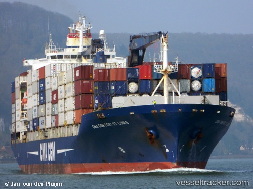
 CMA CGM FORT ST LOUIS
Current Status
Where is the vessel?
CMA CGM FORT ST LOUIS is currently in 158 nm NE of San Andrés, based on AIS data received about 1h ago.
Latest AIS update:
Current position: 13.95833° N, 79.39500° W (158 nm NE of San Andrés)
Average speed (last 7 days): Loading…
Average speed (last 30 days): Loading…
Vessel profile: CMA CGM FORT ST LOUIS is a Container Ship with dimensions 198m x 30m.
This page combines live AIS, route history, probable destination signals, nearby traffic, and port activity for practical vessel monitoring.
The current position of vessel CMA CGM FORT ST LOUIS is 13.95833 lat / -79.39500 lng. Updated: 2026-04-21 20:09:25 UTCCurrently sailing under the flag of Cyprus ![]()
CMA CGM FORT ST LOUIS built in 2003 year
Deadweight:
30804 tDetails:
Live Vessel CMA CGM FORT ST LOUIS Analytics (details, animations, etc.)
Recent AIS points (UTC):
2026-04-21 16:17:50 UTC · 14.66167, -78.76500 · SOG 16 kn · COG -1°2026-04-21 18:15:08 UTC · 14.27500, -79.10667 · SOG 13 kn · COG -1°
2026-04-21 19:15:13 UTC · 14.10833, -79.25667 · SOG 13 kn · COG -1°
2026-04-21 20:09:25 UTC · 13.95833, -79.39500 · SOG 14 kn · COG -1°