 vesseltracker.com
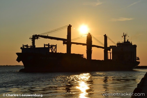
 MERATUS AMPANA
Current Status
Where is the vessel?
MERATUS AMPANA is currently in Near Belawan, based on AIS data received about 2h ago.
Latest AIS update:
Current position: 3.79306° N, 98.71452° E (Near Belawan)
Average speed (last 7 days): Loading…
Average speed (last 30 days): Loading…
Vessel profile: MERATUS AMPANA is a General Cargo Ship with dimensions 179m x 27m.
This page combines live AIS, route history, probable destination signals, nearby traffic, and port activity for practical vessel monitoring.
The current position of vessel MERATUS AMPANA is 3.79306 lat / 98.71452 lng. Updated: 2026-04-18 04:02:43 UTCNearest reference points:
- Near Belawan
- 10 nm NE of Belawan
- 43 nm NE of Perbaungan
Currently sailing under the flag of Indonesia ![]()
MERATUS AMPANA built in 2002 year
Deadweight:
27403 tDetails:
Live Vessel MERATUS AMPANA Analytics (details, animations, etc.)
Recent AIS points (UTC):
2026-04-17 22:17:36 UTC · 3.79306, 98.71453 · SOG 0 kn · COG 46°2026-04-18 00:19:40 UTC · 3.79167, 98.71333 · SOG 0 kn · COG -1°
2026-04-18 01:52:42 UTC · 3.79167, 98.71333 · SOG 0 kn · COG -1°
2026-04-18 04:02:43 UTC · 3.79306, 98.71452 · SOG 0 kn · COG 46°