 vesseltracker.com
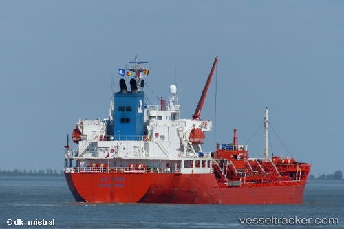
Stolt Kiri
Current StatusWhere is the vessel?
Stolt Kiri is currently in Near Pasadena, based on AIS data received about 1h ago.
Latest AIS update:
Current position: 29.74330° N, 95.09837° W (Near Pasadena)
Average speed (last 7 days): Loading…
Average speed (last 30 days): Loading…
Vessel profile: Stolt Kiri is a Chemical Oil Products Tanker with dimensions 24m x 145m.
This page combines live AIS, route history, probable destination signals, nearby traffic, and port activity for practical vessel monitoring.
The current position of vessel Stolt Kiri is 29.74330 lat / -95.09837 lng. Updated: 2026-04-19 11:43:35 UTCNearest reference points:
- Near Jacinto City
- Near Morgan Point
- Near Pasadena
Details:
Live Vessel Stolt Kiri Analytics (details, animations, etc.)
Recent AIS points (UTC):
2026-04-19 07:28:33 UTC · 29.74331, -95.09836 · SOG 0 kn · COG 317°2026-04-19 10:16:30 UTC · 29.74329, -95.09836 · SOG 0 kn · COG 317°
2026-04-19 10:43:32 UTC · 29.74330, -95.09839 · SOG 0 kn · COG 317°
2026-04-19 11:43:35 UTC · 29.74330, -95.09837 · SOG 0 kn · COG 317°