 vesseltracker.com
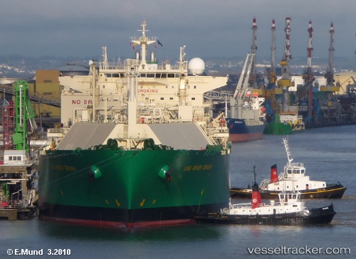
Lng River Orashi
Current StatusWhere is the vessel?
Lng River Orashi is currently in Near BUKOM ISLAND, based on AIS data received about 80d ago.
Latest AIS update:
Current position: 1.17682° N, 103.69989° E (Near BUKOM ISLAND)
Average speed (last 7 days): Loading…
Average speed (last 30 days): Loading…
Vessel profile: Lng River Orashi is a Lng Tanker with dimensions 43m x 285m.
This page combines live AIS, route history, probable destination signals, nearby traffic, and port activity for practical vessel monitoring.
The current position of vessel Lng River Orashi is 1.17682 lat / 103.69989 lng. Updated: 2026-01-06 02:12:23 UTCNearest reference points:
- Near BUKOM ISLAND
- Near JURONG ISLAND
- Near Pulau Ayer Chawan
Details:
Live Vessel Lng River Orashi Analytics (details, animations, etc.)
Recent AIS points (UTC):
2026-01-06 02:12:23 UTC · 1.17682, 103.69989 · SOG 0.1 kn · COG 138°