 vesseltracker.com
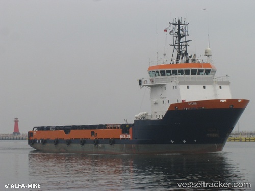
 Sylur
Sylur
Current Status
Where is the vessel?
Sylur is currently in Near Gdansk, based on AIS data received less than 1h ago.
Latest AIS update:
Current position: 54.35608° N, 18.67441° E (Near Gdansk)
Average speed (last 7 days): Loading…
Average speed (last 30 days): Loading…
Vessel profile: Sylur is a Offshore Tug Supply Ship with dimensions 72m x 16m.
This page combines live AIS, route history, probable destination signals, nearby traffic, and port activity for practical vessel monitoring.
The current position of vessel Sylur is 54.35608 lat / 18.67441 lng. Updated: 2026-04-13 15:20:02 UTCNearest reference points:
- Near Nowy Port/Gdansk
- Near Górki Zachodnie
- Near Sopot
Currently sailing under the flag of Cyprus ![]()
Sylur built in 2003 year
Deadweight:
3350 tDetails:
Live Vessel Sylur Analytics (details, animations, etc.)
Recent AIS points (UTC):
2026-04-13 09:54:15 UTC · 54.35612, 18.67450 · SOG 0 kn · COG 133°2026-04-13 11:50:20 UTC · 54.35614, 18.67452 · SOG 0 kn · COG 134°
2026-04-13 14:25:59 UTC · 54.35616, 18.67443 · SOG 0 kn · COG 133°
2026-04-13 15:20:02 UTC · 54.35608, 18.67441 · SOG 0 kn · COG 134°