 vesseltracker.com
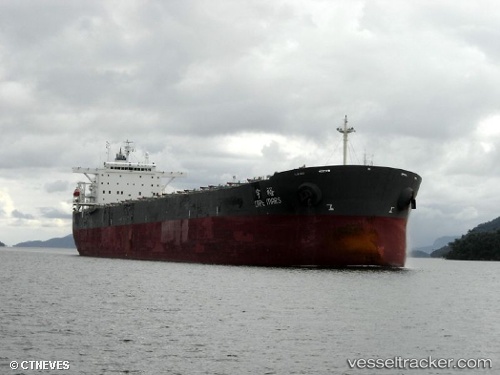
 CAPE BOSS
Current Status
Where is the vessel?
CAPE BOSS is currently in 171 nm NE of Dokdo, based on AIS data received about 2h ago.
Latest AIS update:
Current position: 39.83090° N, 133.35674° E (171 nm NE of Dokdo)
Average speed (last 7 days): Loading…
Average speed (last 30 days): Loading…
Vessel profile: CAPE BOSS is a Bulk Carrier with dimensions 289m x 289m.
This page combines live AIS, route history, probable destination signals, nearby traffic, and port activity for practical vessel monitoring.
The current position of vessel CAPE BOSS is 39.83090 lat / 133.35674 lng. Updated: 2026-04-20 02:33:37 UTCNearest reference points:
- 113 nm S of Askold
- 110 nm S of Askold
- 94 nm N of Dokdo
Currently sailing under the flag of Liberia ![]()
CAPE BOSS built in 2003 year
Deadweight:
175775 tDetails:
Live Vessel CAPE BOSS Analytics (details, animations, etc.)
Recent AIS points (UTC):
2026-04-20 01:42:37 UTC · 39.95693, 133.45895 · SOG 11 kn · COG 212°2026-04-20 02:24:28 UTC · 39.85307, 133.37213 · SOG 9.9 kn · COG 209°
2026-04-20 02:33:37 UTC · 39.83090, 133.35674 · SOG 9.8 kn · COG 208°
2026-04-20 02:33:37 UTC · 39.83090, 133.35674 · SOG 9.8 kn · COG 208°