 vesseltracker.com
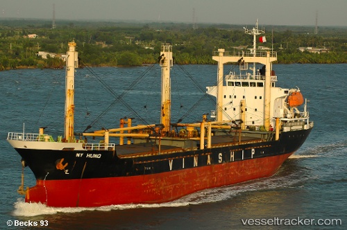
My Hung
Current StatusWhere is the vessel?
My Hung is currently in Near Flying Fish Cove, based on AIS data received less than 1h ago.
Latest AIS update:
Current position: 10.42442° S, 105.59398° E (Near Flying Fish Cove)
Average speed (last 7 days): Loading…
Average speed (last 30 days): Loading…
Vessel profile: My Hung is a General Cargo Ship with dimensions 17m x 102m.
This page combines live AIS, route history, probable destination signals, nearby traffic, and port activity for practical vessel monitoring.
The current position of vessel My Hung is -10.42442 lat / 105.59398 lng. Updated: 2026-04-17 09:45:26 UTCNearest reference points:
- 103 nm S of Flying Fish Cove
Details:
Live Vessel My Hung Analytics (details, animations, etc.)
Recent AIS points (UTC):
2026-04-17 03:29:21 UTC · -10.45833, 105.45833 · SOG 2 kn · COG -1°2026-04-17 05:56:44 UTC · -10.44988, 105.40418 · SOG 5.4 kn · COG 75°
2026-04-17 07:30:38 UTC · -10.44304, 105.58610 · SOG 4.4 kn · COG 75°
2026-04-17 09:45:26 UTC · -10.42442, 105.59398 · SOG 2 kn · COG 310°