 vesseltracker.com
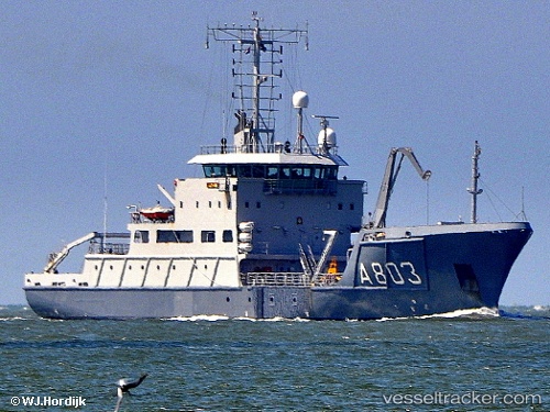
Survey Vessel Luymes
Current StatusWhere is the vessel?
Survey Vessel Luymes is currently in 25 nm N of Hijum, based on AIS data received about 1h ago.
Latest AIS update:
Current position: 53.72193° N, 4.78134° E (25 nm N of Hijum)
Average speed (last 7 days): Loading…
Average speed (last 30 days): Loading…
Vessel profile: Survey Vessel Luymes is a Research Vessel with dimensions 14m x 82m.
This page combines live AIS, route history, probable destination signals, nearby traffic, and port activity for practical vessel monitoring.
The current position of vessel Survey Vessel Luymes is 53.72193 lat / 4.78134 lng. Updated: 2026-03-31 23:50:40 UTCNearest reference points:
- Near Molengat
- Near de Waal
- Near OUDESCHILD
Details:
Live Vessel Survey Vessel Luymes Analytics (details, animations, etc.)
Recent AIS points (UTC):
2026-03-31 18:17:11 UTC · 54.77871, 5.49634 · SOG 12.6 kn · COG -1°2026-03-31 19:47:09 UTC · 54.50653, 5.27286 · SOG 12.5 kn · COG 209°
2026-03-31 22:19:29 UTC · 54.02880, 4.94060 · SOG 12.9 kn · COG 196°
2026-03-31 23:50:40 UTC · 53.72193, 4.78134 · SOG 13.7 kn · COG 211°