 vesseltracker.com
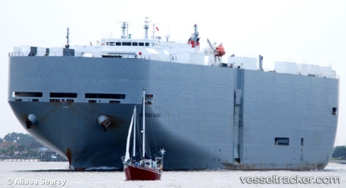
 Indiana Highway
Current Status
Where is the vessel?
Indiana Highway is currently in 42 nm W of Los Cabos, based on AIS data received about 16h ago.
Latest AIS update:
Current position: 22.74912° N, 110.65391° W (42 nm W of Los Cabos)
Average speed (last 7 days): Loading…
Average speed (last 30 days): Loading…
Vessel profile: Indiana Highway is a Vehicles Carrier with dimensions 200m x 32m.
This page combines live AIS, route history, probable destination signals, nearby traffic, and port activity for practical vessel monitoring.
The current position of vessel Indiana Highway is 22.74912 lat / -110.65391 lng. Updated: 2026-04-10 07:53:37 UTCNearest reference points:
- 69 nm W of Los Cabos
- 71 nm W of Los Cabos
- 73 nm W of Los Cabos
Currently sailing under the flag of Japan ![]()
Indiana Highway built in 2003 year
Deadweight:
17442 tDetails:
Live Vessel Indiana Highway Analytics (details, animations, etc.)
Recent AIS points (UTC):
2026-04-10 01:20:45 UTC · 23.60423, -112.31811 · SOG 16.5 kn · COG 124°2026-04-10 03:36:12 UTC · 23.26039, -111.76536 · SOG 16 kn · COG 113°
2026-04-10 05:48:06 UTC · 23.01205, -111.19122 · SOG 15.9 kn · COG 117°
2026-04-10 07:53:37 UTC · 22.74912, -110.65391 · SOG 16.1 kn · COG 117°