 vesseltracker.com
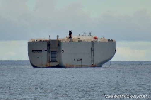
 Texas Highway
Current Status
Where is the vessel?
Texas Highway is currently in 109 nm NW of Yoke Bay, based on AIS data received less than 1h ago.
Latest AIS update:
Current position: 53.66599° N, 177.30765° W (109 nm NW of Yoke Bay)
Average speed (last 7 days): Loading…
Average speed (last 30 days): Loading…
Vessel profile: Texas Highway is a Vehicles Carrier with dimensions 199m x 199m.
This page combines live AIS, route history, probable destination signals, nearby traffic, and port activity for practical vessel monitoring.
The current position of vessel Texas Highway is 53.66599 lat / -177.30765 lng. Updated: 2026-03-31 12:19:08 UTCCurrently sailing under the flag of Japan ![]()
Texas Highway built in 2003 year
Deadweight:
17481 tDetails:
Live Vessel Texas Highway Analytics (details, animations, etc.)
Recent AIS points (UTC):
2026-03-31 05:31:19 UTC · 53.41129, 179.75253 · SOG 15.3 kn · COG 77°2026-03-31 08:23:30 UTC · 53.53038, -179.00542 · SOG 15.5 kn · COG 80°
2026-03-31 09:52:09 UTC · 53.58114, -178.37761 · SOG 15.3 kn · COG 84°
2026-03-31 12:19:08 UTC · 53.66599, -177.30765 · SOG 15.8 kn · COG 80°