 vesseltracker.com
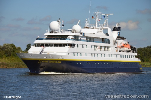
 Nat geo Orion
Current Status
Where is the vessel?
Nat geo Orion is currently in 108 nm NW of Las Brujas, based on AIS data received less than 1h ago.
Latest AIS update:
Current position: 24.49167° N, 20.03833° W (108 nm NW of Las Brujas)
Average speed (last 7 days): Loading…
Average speed (last 30 days): Loading…
Vessel profile: Nat geo Orion is a Cruise Ship with dimensions 103m x 14m.
This page combines live AIS, route history, probable destination signals, nearby traffic, and port activity for practical vessel monitoring.
The current position of vessel Nat geo Orion is 24.49167 lat / -20.03833 lng. Updated: 2026-03-29 23:52:40 UTCCurrently sailing under the flag of Bahamas ![]()
Nat geo Orion built in 2003 year
Deadweight:
668 tDetails:
Live Vessel Nat geo Orion Analytics (details, animations, etc.)
Recent AIS points (UTC):
2026-03-29 17:34:37 UTC · 23.78333, -20.63833 · SOG 8 kn · COG -1°2026-03-29 19:49:42 UTC · 24.01140, -20.40463 · SOG 8.9 kn · COG 37°
2026-03-29 22:15:42 UTC · 24.30140, -20.18418 · SOG 8.9 kn · COG 38°
2026-03-29 23:52:40 UTC · 24.49167, -20.03833 · SOG 8 kn · COG -1°