 vesseltracker.com
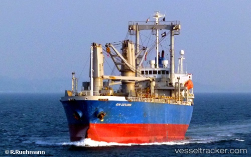
Toyo Energy
Current StatusWhere is the vessel?
Toyo Energy is currently in Near KRONG PREAH SIHANOUK, based on AIS data received less than 1h ago.
Latest AIS update:
Current position: 10.64734° N, 103.50791° E (Near KRONG PREAH SIHANOUK)
Average speed (last 7 days): Loading…
Average speed (last 30 days): Loading…
Vessel profile: Toyo Energy is a General Cargo Ship with dimensions 20m x 117m.
This page combines live AIS, route history, probable destination signals, nearby traffic, and port activity for practical vessel monitoring.
The current position of vessel Toyo Energy is 10.64734 lat / 103.50791 lng. Updated: 2026-04-12 06:56:34 UTCNearest reference points:
- Near KRONG PREAH SIHANOUK
- 63 nm NW of Dai Hung (STS Load)
- 43 nm E of Benchamas
Details:
Live Vessel Toyo Energy Analytics (details, animations, etc.)
Recent AIS points (UTC):
2026-04-10 04:14:20 UTC · 1.36021, 104.42319 · SOG 13.4 kn · COG 52°2026-04-10 05:53:59 UTC · 1.63652, 104.61397 · SOG 12.6 kn · COG 12°
2026-04-10 08:09:00 UTC · 2.08592, 104.65020 · SOG 11.5 kn · COG 5°
2026-04-12 06:56:34 UTC · 10.64734, 103.50791 · SOG 0 kn · COG 253°