 vesseltracker.com
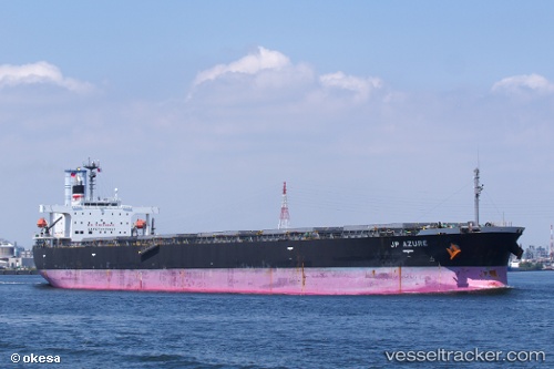
 ORIENTAL STAR
Current Status
Where is the vessel?
ORIENTAL STAR is currently in 93 nm SW of Amio, based on AIS data received less than 1h ago.
Latest AIS update:
Current position: 7.31853° S, 149.77274° E (93 nm SW of Amio)
Average speed (last 7 days): Loading…
Average speed (last 30 days): Loading…
Vessel profile: ORIENTAL STAR is a Bulk Carrier with dimensions 38m x 230m.
This page combines live AIS, route history, probable destination signals, nearby traffic, and port activity for practical vessel monitoring.
The current position of vessel ORIENTAL STAR is -7.31853 lat / 149.77274 lng. Updated: 2026-04-21 19:48:08 UTCNearest reference points:
- 42 nm E of Tami Island
Currently sailing under the flag of Korea (Republic of) ![]()
ORIENTAL STAR built in 2005 year
Deadweight:
88111 tDetails:
Live Vessel ORIENTAL STAR Analytics (details, animations, etc.)
Recent AIS points (UTC):
2026-04-21 15:52:46 UTC · -6.92870, 149.19133 · SOG 10.6 kn · COG 119°2026-04-21 18:02:08 UTC · -7.12812, 149.51694 · SOG 10.5 kn · COG 132°
2026-04-21 19:29:36 UTC · -7.28623, 149.72627 · SOG 10.9 kn · COG 130°
2026-04-21 19:48:08 UTC · -7.31853, 149.77274 · SOG 10.9 kn · COG 123°