 vesseltracker.com
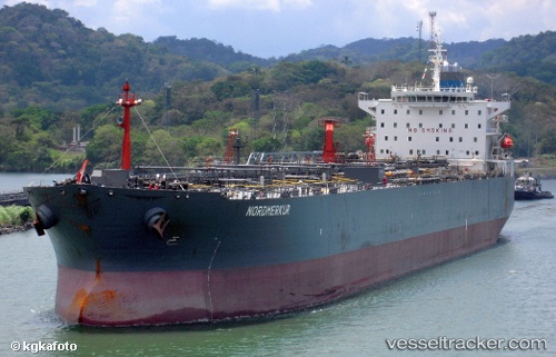
 KING CHAIN
Current Status
Where is the vessel?
KING CHAIN is currently in Near Slipi, based on AIS data received about 2h ago.
Latest AIS update:
Current position: 6.26828° N, 106.87658° E (Near Slipi)
Average speed (last 7 days): Loading…
Average speed (last 30 days): Loading…
Vessel profile: KING CHAIN is a Oil Products Tanker with dimensions m x m.
This page combines live AIS, route history, probable destination signals, nearby traffic, and port activity for practical vessel monitoring.
The current position of vessel KING CHAIN is 6.26828 lat / 106.87658 lng. Updated: 2026-03-31 08:57:29 UTCNearest reference points:
- 36 nm SW of Slipi
- 46 nm E of Kakap Natuna Terminal
- 45 nm E of Kakap Natuna Terminal
Currently sailing under the flag of Cameroon ![]()
Details:
Live Vessel KING CHAIN Analytics (details, animations, etc.)
Recent AIS points (UTC):
2026-03-31 03:34:40 UTC · 5.39225, 106.48807 · SOG 10.8 kn · COG 23°2026-03-31 05:56:11 UTC · 5.79177, 106.66473 · SOG 10.4 kn · COG 24°
2026-03-31 07:40:30 UTC · 6.06902, 106.78748 · SOG 9.8 kn · COG 25°
2026-03-31 08:57:29 UTC · 6.26828, 106.87658 · SOG 10.1 kn · COG -1°