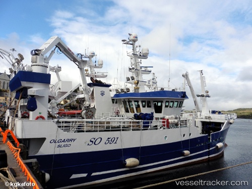
 Olgarry
Current Status
Where is the vessel?
Olgarry is currently in Near KILLYBEGS, based on AIS data received about 15h ago.
Latest AIS update:
Current position: 54.63344° N, 8.44321° W (Near KILLYBEGS)
Average speed (last 7 days): Loading…
Average speed (last 30 days): Loading…
Vessel profile: Olgarry is a Fishing Vessel with dimensions 50m x 12m.
This page combines live AIS, route history, probable destination signals, nearby traffic, and port activity for practical vessel monitoring.
The current position of vessel Olgarry is 54.63344 lat / -8.44321 lng. Updated: 2026-05-24 03:52:42 UTCNearest reference points:
- 10 nm NE of Belmullet
- Near Tarbert Island
- Near GREENORE
Currently sailing under the flag of Ireland ![]()
Olgarry built in 2003 year
Deadweight:
660 tDetails:
Live Vessel Olgarry Analytics (details, animations, etc.)
Recent AIS points (UTC):
2026-05-24 00:22:50 UTC · 54.63347, -8.44326 · SOG 0 kn · COG 26°2026-05-24 01:22:30 UTC · 54.63346, -8.44325 · SOG 0 kn · COG 25°
2026-05-24 01:48:00 UTC · 54.63347, -8.44328 · SOG 0 kn · COG 25°
2026-05-24 03:52:42 UTC · 54.63344, -8.44321 · SOG 0 kn · COG 27°