 vesseltracker.com
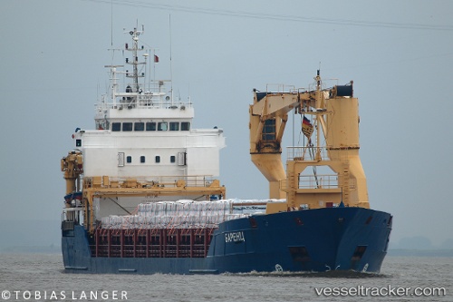
 BARENTS
Current Status
Where is the vessel?
BARENTS is currently in Near Marmara Adasi, based on AIS data received about 2h ago.
Latest AIS update:
Current position: 40.67983° N, 27.40900° E (Near Marmara Adasi)
Average speed (last 7 days): Loading…
Average speed (last 30 days): Loading…
Vessel profile: BARENTS is a Multi Purpose Carrier with dimensions 99m x 14m.
This page combines live AIS, route history, probable destination signals, nearby traffic, and port activity for practical vessel monitoring.
The current position of vessel BARENTS is 40.67983 lat / 27.40900 lng. Updated: 2026-04-21 05:13:55 UTCNearest reference points:
- Near Saraylar
- Near Sarköy
- Near Marmara Adasi
Currently sailing under the flag of Russia ![]()
BARENTS built in 2003 year
Deadweight:
4303 tDetails:
Live Vessel BARENTS Analytics (details, animations, etc.)
Recent AIS points (UTC):
2026-04-21 02:07:36 UTC · 40.80933, 28.02600 · SOG 10.5 kn · COG 259°2026-04-21 04:04:08 UTC · 40.75833, 27.62550 · SOG 8.6 kn · COG 246°
2026-04-21 04:43:37 UTC · 40.71817, 27.51283 · SOG 8.5 kn · COG 242°
2026-04-21 05:13:55 UTC · 40.67983, 27.40900 · SOG 11.3 kn · COG 241°