 vesseltracker.com
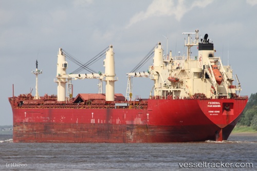
Federal Nakagawa
Current StatusWhere is the vessel?
Federal Nakagawa is currently in 63 nm SW of Lower Sackville, based on AIS data received about 1h ago.
Latest AIS update:
Current position: 45.66407° N, 42.46681° W (63 nm SW of Lower Sackville)
Average speed (last 7 days): Loading…
Average speed (last 30 days): Loading…
Vessel profile: Federal Nakagawa is a Bulk Carrier with dimensions 24m x 199m.
This page combines live AIS, route history, probable destination signals, nearby traffic, and port activity for practical vessel monitoring.
The current position of vessel Federal Nakagawa is 45.66407 lat / -42.46681 lng. Updated: 2026-04-19 11:34:16 UTCNearest reference points:
- 70 nm N of Lower Sackville
Details:
Live Vessel Federal Nakagawa Analytics (details, animations, etc.)
Recent AIS points (UTC):
2026-04-19 07:49:26 UTC · 45.37603, -43.22199 · SOG 9.1 kn · COG 51°2026-04-19 10:21:59 UTC · 45.58948, -42.72765 · SOG 10.5 kn · COG 60°
2026-04-19 10:28:27 UTC · 45.59829, -42.70313 · SOG 10.7 kn · COG 61°
2026-04-19 11:34:16 UTC · 45.66407, -42.46681 · SOG 9.4 kn · COG 90°