 vesseltracker.com
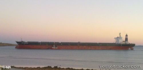
 WINNING EXCELLENCE
Current Status
Where is the vessel?
WINNING EXCELLENCE is currently in 149 nm SW of L'Étang-Salé, based on AIS data received about 1h ago.
Latest AIS update:
Current position: 23.06709° S, 53.52865° E (149 nm SW of L'Étang-Salé)
Average speed (last 7 days): Loading…
Average speed (last 30 days): Loading…
Vessel profile: WINNING EXCELLENCE is a Ore Carrier with dimensions 54m x 319m.
This page combines live AIS, route history, probable destination signals, nearby traffic, and port activity for practical vessel monitoring.
The current position of vessel WINNING EXCELLENCE is -23.06709 lat / 53.52865 lng. Updated: 2026-03-31 11:50:32 UTCNearest reference points:
- 209 nm E of Manakara
- 194 nm E of Manakara
Currently sailing under the flag of Singapore ![]()
WINNING EXCELLENCE built in 2004 year
Deadweight:
229186 tDetails:
Live Vessel WINNING EXCELLENCE Analytics (details, animations, etc.)
Recent AIS points (UTC):
2026-03-31 06:12:27 UTC · -22.56876, 54.50457 · SOG 11 kn · COG 240°2026-03-31 07:54:57 UTC · -22.71948, 54.21245 · SOG 10.9 kn · COG 245°
2026-03-31 09:27:55 UTC · -22.86013, 53.93968 · SOG 11.1 kn · COG 245°
2026-03-31 11:50:32 UTC · -23.06709, 53.52865 · SOG 10.9 kn · COG 244°