 vesseltracker.com
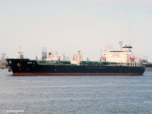
 Hope A
Current Status
Where is the vessel?
Hope A is currently in Near Thessaloniki, based on AIS data received about 1h ago.
Latest AIS update:
Current position: 40.62950° N, 22.89230° E (Near Thessaloniki)
Average speed (last 7 days): Loading…
Average speed (last 30 days): Loading…
Vessel profile: Hope A is a Chemical Oil Products Tanker with dimensions 171m x 28m.
This page combines live AIS, route history, probable destination signals, nearby traffic, and port activity for practical vessel monitoring.
The current position of vessel Hope A is 40.6295 lat / 22.8923 lng. Updated: 2026-04-08 05:46:43 UTCNearest reference points:
- Near Ammoulianí
- Near Agriá
- Near Volos
Currently sailing under the flag of Malta ![]()
Hope A built in 2004 year
Deadweight:
40095 tDetails:
Live Vessel Hope A Analytics (details, animations, etc.)
Recent AIS points (UTC):
2026-04-07 23:22:43 UTC · 40.62950, 22.89230 · SOG 0 kn · COG 160°2026-04-08 01:52:44 UTC · 40.62950, 22.89230 · SOG 0 kn · COG 160°
2026-04-08 03:25:44 UTC · 40.62950, 22.89230 · SOG 0 kn · COG 160°
2026-04-08 05:46:43 UTC · 40.62950, 22.89230 · SOG 0.1 kn · COG 160°