 vesseltracker.com
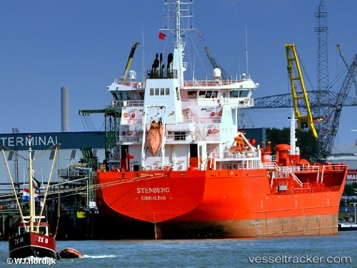
 STENBERG
Current Status
Where is the vessel?
STENBERG is currently in Near Pijp Tabak, based on AIS data received less than 1h ago.
Latest AIS update:
Current position: 51.26500° N, 4.34167° E (Near Pijp Tabak)
Average speed (last 7 days): Loading…
Average speed (last 30 days): Loading…
Vessel profile: STENBERG is a Oil/Chemical Tanker with dimensions m x m.
This page combines live AIS, route history, probable destination signals, nearby traffic, and port activity for practical vessel monitoring.
The current position of vessel STENBERG is 51.26500 lat / 4.34167 lng. Updated: 2026-04-22 03:21:53 UTCNearest reference points:
- Near Antwerp
- Near Kallo
- Near Kruibeke
Currently sailing under the flag of Portugal ![]()
Details:
Live Vessel STENBERG Analytics (details, animations, etc.)
Recent AIS points (UTC):
2026-04-21 23:25:40 UTC · 51.26503, 4.34304 · SOG 0 kn · COG 317°2026-04-22 01:52:32 UTC · 51.26504, 4.34307 · SOG 0 kn · COG 317°
2026-04-22 02:16:33 UTC · 51.26503, 4.34304 · SOG 0 kn · COG 317°
2026-04-22 03:21:53 UTC · 51.26500, 4.34167 · SOG 0 kn · COG -1°