 vesseltracker.com
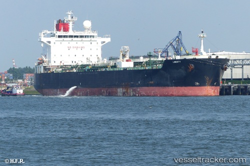
 BILI
BILI
Current Status
Where is the vessel?
BILI is currently in 39 nm N of Offshore Fujairah, based on AIS data received less than 1h ago.
Latest AIS update:
Current position: 25.85328° N, 56.94171° E (39 nm N of Offshore Fujairah)
Average speed (last 7 days): Loading…
Average speed (last 30 days): Loading…
Vessel profile: BILI is a Crude Oil Tanker with dimensions m x m.
This page combines live AIS, route history, probable destination signals, nearby traffic, and port activity for practical vessel monitoring.
The current position of vessel BILI is 25.85328 lat / 56.94171 lng. Updated: 2026-04-21 05:57:38 UTCNearest reference points:
- 34 nm NE of Offshore Fujairah
- 30 nm NE of Offshore Fujairah
- 29 nm NE of Offshore Fujairah
Currently sailing under the flag of Gambia ![]()
Details:
Live Vessel BILI Analytics (details, animations, etc.)
Recent AIS points (UTC):
2026-04-21 02:36:00 UTC · 25.85328, 56.94170 · SOG 0.1 kn · COG 97°2026-04-21 04:17:08 UTC · 25.85335, 56.94168 · SOG 0.1 kn · COG 97°
2026-04-21 04:32:08 UTC · 25.85333, 56.94166 · SOG 0.1 kn · COG 97°
2026-04-21 05:57:38 UTC · 25.85328, 56.94171 · SOG 0.1 kn · COG 97°