 vesseltracker.com
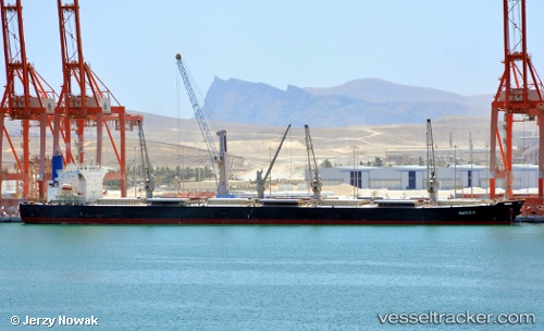
Peony Laut
Current StatusWhere is the vessel?
Peony Laut is currently in 70 nm N of KENDARI, based on AIS data received about 1h ago.
Latest AIS update:
Current position: 2.86145° S, 122.24187° E (70 nm N of KENDARI)
Average speed (last 7 days): Loading…
Average speed (last 30 days): Loading…
Vessel profile: Peony Laut is a Bulk Carrier with dimensions 32m x 225m.
This page combines live AIS, route history, probable destination signals, nearby traffic, and port activity for practical vessel monitoring.
The current position of vessel Peony Laut is -2.86145 lat / 122.24187 lng. Updated: 2026-04-19 15:56:39 UTCNearest reference points:
- 45 nm N of KENDARI
- 11 nm NW of KENDARI
- 22 nm S of Tangkiang
Details:
Live Vessel Peony Laut Analytics (details, animations, etc.)
Recent AIS points (UTC):
2026-04-19 13:07:59 UTC · -2.86178, 122.24070 · SOG 0.1 kn · COG 131°2026-04-19 13:40:59 UTC · -2.86202, 122.24032 · SOG 0.1 kn · COG 125°
2026-04-19 15:26:36 UTC · -2.86135, 122.24157 · SOG 0.3 kn · COG -1°
2026-04-19 15:56:39 UTC · -2.86145, 122.24187 · SOG 0.1 kn · COG -1°