 vesseltracker.com
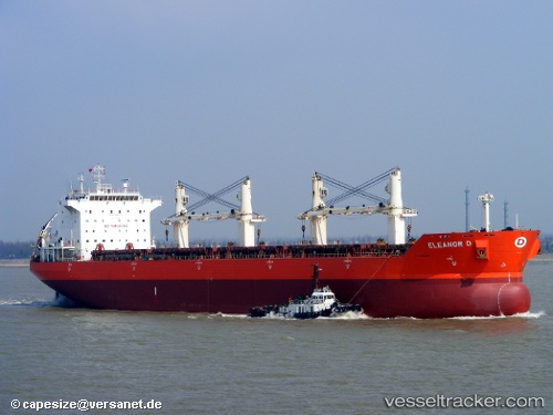
 JINMING 69
Current Status
Where is the vessel?
JINMING 69 is currently in Near Mina Al Ahmadi, based on AIS data received about 4d ago.
Latest AIS update:
Current position: 29.05891° N, 48.16531° E (Near Mina Al Ahmadi)
Average speed (last 7 days): Loading…
Average speed (last 30 days): Loading…
Vessel profile: JINMING 69 is a Bulk Carrier with dimensions m x m.
This page combines live AIS, route history, probable destination signals, nearby traffic, and port activity for practical vessel monitoring.
The current position of vessel JINMING 69 is 29.05891 lat / 48.16531 lng. Updated: 2026-04-03 06:24:20 UTCNearest reference points:
- Near SHUAIBA
- Near Mina Az Zawr
- Near Ra's al Ard
Currently sailing under the flag of Barbados ![]()
Details:
Live Vessel JINMING 69 Analytics (details, animations, etc.)
Recent AIS points (UTC):
2026-04-03 06:07:10 UTC · 29.05891, 48.16531 · SOG 0 kn · COG 163°2026-04-03 06:24:20 UTC · 29.05891, 48.16531 · SOG 0 kn · COG -1°
2026-04-03 06:24:20 UTC · 29.05891, 48.16531 · SOG 0 kn · COG -1°
2026-04-03 06:24:20 UTC · 29.05891, 48.16531 · SOG 0 kn · COG -1°