 vesseltracker.com
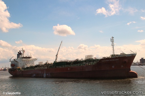
 Sg Friendship
Current Status
Where is the vessel?
Sg Friendship is currently in 75 nm E of Konwelana, based on AIS data received about 1h ago.
Latest AIS update:
Current position: 5.79095° N, 82.46628° E (75 nm E of Konwelana)
Average speed (last 7 days): Loading…
Average speed (last 30 days): Loading…
Vessel profile: Sg Friendship is a Chemical Oil Products Tanker with dimensions 144m x 24m.
This page combines live AIS, route history, probable destination signals, nearby traffic, and port activity for practical vessel monitoring.
The current position of vessel Sg Friendship is 5.79095 lat / 82.46628 lng. Updated: 2026-03-30 19:56:11 UTCNearest reference points:
- 75 nm E of Konwelana
- 79 nm E of Konwelana
- 53 nm SE of Konwelana
Currently sailing under the flag of Panama ![]()
Sg Friendship built in 2003 year
Deadweight:
19772 tDetails:
Live Vessel Sg Friendship Analytics (details, animations, etc.)
Recent AIS points (UTC):
2026-03-30 14:02:16 UTC · 5.73872, 81.23757 · SOG 12.5 kn · COG -1°2026-03-30 16:16:41 UTC · 5.74443, 81.69577 · SOG 12.3 kn · COG 89°
2026-03-30 18:16:18 UTC · 5.76300, 82.11235 · SOG 12.6 kn · COG 86°
2026-03-30 19:56:11 UTC · 5.79095, 82.46628 · SOG 12.8 kn · COG 89°