 vesseltracker.com
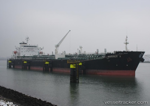
 Mariner A
Current Status
Where is the vessel?
Mariner A is currently in 61 nm SE of Harper, based on AIS data received about 1h ago.
Latest AIS update:
Current position: 3.61948° N, 7.02296° W (61 nm SE of Harper)
Average speed (last 7 days): Loading…
Average speed (last 30 days): Loading…
Vessel profile: Mariner A is a Chemical Oil Products Tanker with dimensions 176m x 31m.
This page combines live AIS, route history, probable destination signals, nearby traffic, and port activity for practical vessel monitoring.
The current position of vessel Mariner A is 3.61948 lat / -7.02296 lng. Updated: 2026-03-28 01:43:13 UTCNearest reference points:
- 98 nm SW of Harper
- 160 nm S of Harper
Currently sailing under the flag of Malta ![]()
Mariner A built in 2005 year
Deadweight:
40099 tDetails:
Live Vessel Mariner A Analytics (details, animations, etc.)
Recent AIS points (UTC):
2026-03-27 20:02:08 UTC · 3.78257, -8.35840 · SOG 14.2 kn · COG 113°2026-03-27 21:59:08 UTC · 3.64360, -7.92034 · SOG 14.3 kn · COG 99°
2026-03-27 23:52:14 UTC · 3.62817, -7.46793 · SOG 14.4 kn · COG 93°
2026-03-28 01:43:13 UTC · 3.61948, -7.02296 · SOG 14.5 kn · COG 93°