 vesseltracker.com
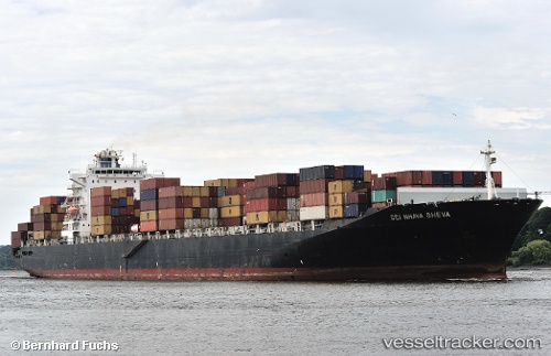
 OOCL ST.LAWRENCE
Current Status
Where is the vessel?
OOCL ST.LAWRENCE is currently in Near Longue-Pointe, based on AIS data received less than 1h ago.
Latest AIS update:
Current position: 45.58999° N, 73.50469° W (Near Longue-Pointe)
Average speed (last 7 days): Loading…
Average speed (last 30 days): Loading…
Vessel profile: OOCL ST.LAWRENCE is a Container Ship with dimensions m x m.
This page combines live AIS, route history, probable destination signals, nearby traffic, and port activity for practical vessel monitoring.
The current position of vessel OOCL ST.LAWRENCE is 45.58999 lat / -73.50469 lng. Updated: 2026-04-18 19:56:37 UTCNearest reference points:
- Near Montréal-Est
- Near Longueuil
- Near Montreal
Currently sailing under the flag of Marshall Islands ![]()
Details:
Live Vessel OOCL ST.LAWRENCE Analytics (details, animations, etc.)
Recent AIS points (UTC):
2026-04-18 13:41:39 UTC · 45.58995, -73.50468 · SOG 0 kn · COG 166°2026-04-18 16:20:41 UTC · 45.58999, -73.50471 · SOG 0 kn · COG 166°
2026-04-18 17:59:39 UTC · 45.59000, -73.50466 · SOG 0 kn · COG 166°
2026-04-18 19:56:37 UTC · 45.58999, -73.50469 · SOG 0 kn · COG 166°