 vesseltracker.com
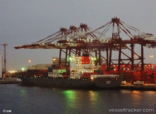
 Limari
Current Status
Where is the vessel?
Limari is currently in Near Lillo, based on AIS data received less than 1h ago.
Latest AIS update:
Current position: 51.28333° N, 4.25500° E (Near Lillo)
Average speed (last 7 days): Loading…
Average speed (last 30 days): Loading…
Vessel profile: Limari is a Container Ship with dimensions 269m x 269m.
This page combines live AIS, route history, probable destination signals, nearby traffic, and port activity for practical vessel monitoring.
The current position of vessel Limari is 51.28333 lat / 4.25500 lng. Updated: 2026-04-20 09:48:49 UTCNearest reference points:
- Near Doel
- Near Kallo
- Near Verrebroek
Currently sailing under the flag of Bermuda ![]()
Limari built in 2005 year
Deadweight:
52683 tDetails:
Live Vessel Limari Analytics (details, animations, etc.)
Recent AIS points (UTC):
2026-04-20 06:00:27 UTC · 51.28458, 4.25650 · SOG 0 kn · COG 33°2026-04-20 07:18:23 UTC · 51.28480, 4.25630 · SOG 0.1 kn · COG 33°
2026-04-20 07:33:32 UTC · 51.28486, 4.25657 · SOG 0.2 kn · COG 33°
2026-04-20 09:48:49 UTC · 51.28333, 4.25500 · SOG 0 kn · COG -1°