 vesseltracker.com
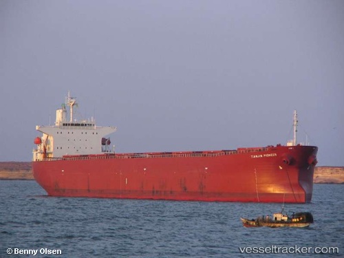
 Erikoussa
Current Status
Where is the vessel?
Erikoussa is currently in 252 nm SE of Honghai, based on AIS data received about 2h ago.
Latest AIS update:
Current position: 17.08500° N, 114.52333° E (252 nm SE of Honghai)
Average speed (last 7 days): Loading…
Average speed (last 30 days): Loading…
Vessel profile: Erikoussa is a Bulk Carrier with dimensions 225m x 32m.
This page combines live AIS, route history, probable destination signals, nearby traffic, and port activity for practical vessel monitoring.
The current position of vessel Erikoussa is 17.08500 lat / 114.52333 lng. Updated: 2026-04-17 23:18:18 UTCNearest reference points:
- 215 nm NE of Tan Cang Qui Nhon
- 222 nm W of Iba
Currently sailing under the flag of Liberia ![]()
Erikoussa built in 2005 year
Deadweight:
75744 tDetails:
Live Vessel Erikoussa Analytics (details, animations, etc.)
Recent AIS points (UTC):
2026-04-17 16:46:03 UTC · 16.14500, 113.70333 · SOG 11 kn · COG -1°2026-04-17 19:43:59 UTC · 16.58243, 114.05365 · SOG 11.3 kn · COG -1°
2026-04-17 21:08:36 UTC · 16.77500, 114.24333 · SOG 11 kn · COG -1°
2026-04-17 23:18:18 UTC · 17.08500, 114.52333 · SOG 11 kn · COG -1°