 vesseltracker.com
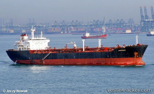
 PETROMAX
Current Status
Where is the vessel?
PETROMAX is currently in 26 nm E of Geomundo, based on AIS data received about 1h ago.
Latest AIS update:
Current position: 33.89411° N, 127.79400° E (26 nm E of Geomundo)
Average speed (last 7 days): Loading…
Average speed (last 30 days): Loading…
Vessel profile: PETROMAX is a Oil Products Tanker with dimensions 27m x 171m.
This page combines live AIS, route history, probable destination signals, nearby traffic, and port activity for practical vessel monitoring.
The current position of vessel PETROMAX is 33.89411 lat / 127.79400 lng. Updated: 2026-04-14 05:28:46 UTCNearest reference points:
- 35 nm E of Geomundo
- 12 nm E of Geomundo
- 25 nm S of Kukdo
Currently sailing under the flag of Indonesia ![]()
PETROMAX built in 2005 year
Deadweight:
34583 tDetails:
Live Vessel PETROMAX Analytics (details, animations, etc.)
Recent AIS points (UTC):
2026-04-13 23:29:50 UTC · 33.75667, 126.25333 · SOG 12 kn · COG -1°2026-04-14 02:20:44 UTC · 33.82500, 126.95833 · SOG 12 kn · COG -1°
2026-04-14 04:06:30 UTC · 33.83347, 127.42934 · SOG 13.9 kn · COG 85°
2026-04-14 05:28:46 UTC · 33.89411, 127.79400 · SOG 12.8 kn · COG 80°