 vesseltracker.com
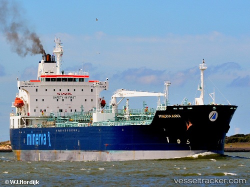
 MINERVA ANNA
Current Status
Where is the vessel?
MINERVA ANNA is currently in 14 nm W of Port Saint Mary, based on AIS data received about 2h ago.
Latest AIS update:
Current position: 54.05293° N, 5.13817° W (14 nm W of Port Saint Mary)
Average speed (last 7 days): Loading…
Average speed (last 30 days): Loading…
Vessel profile: MINERVA ANNA is a Chemical/Oil Products Tanker with dimensions 183m x 32m.
This page combines live AIS, route history, probable destination signals, nearby traffic, and port activity for practical vessel monitoring.
The current position of vessel MINERVA ANNA is 54.05293 lat / -5.13817 lng. Updated: 2026-04-04 01:45:20 UTCNearest reference points:
- Near Crossgar
- Near Douglas
- Near KILKEEL
Currently sailing under the flag of Liberia ![]()
MINERVA ANNA built in 2005 year
Deadweight:
50939 tDetails:
Live Vessel MINERVA ANNA Analytics (details, animations, etc.)
Recent AIS points (UTC):
2026-04-03 20:38:00 UTC · 55.03765, -5.71936 · SOG 14.4 kn · COG 143°2026-04-03 21:36:55 UTC · 54.85530, -5.47168 · SOG 13.9 kn · COG 143°
2026-04-03 23:45:58 UTC · 54.43093, -5.11374 · SOG 12.1 kn · COG 166°
2026-04-04 01:45:20 UTC · 54.05293, -5.13817 · SOG 11.3 kn · COG 189°