 vesseltracker.com
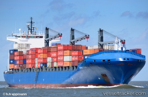
 INDEPENDENT PRIMERO
Current Status
Where is the vessel?
INDEPENDENT PRIMERO is currently in 16 nm E of Bethany Beach, based on AIS data received less than 1h ago.
Latest AIS update:
Current position: 38.51170° N, 74.70902° W (16 nm E of Bethany Beach)
Average speed (last 7 days): Loading…
Average speed (last 30 days): Loading…
Vessel profile: INDEPENDENT PRIMERO is a Container Ship with dimensions m x m.
This page combines live AIS, route history, probable destination signals, nearby traffic, and port activity for practical vessel monitoring.
The current position of vessel INDEPENDENT PRIMERO is 38.51170 lat / -74.70902 lng. Updated: 2026-04-13 16:01:04 UTCNearest reference points:
- 24 nm E of West Ocean City
- Near Slaughter Beach
- Near Corbin City
Currently sailing under the flag of Portugal ![]()
Details:
Live Vessel INDEPENDENT PRIMERO Analytics (details, animations, etc.)
Recent AIS points (UTC):
2026-04-13 09:59:49 UTC · 38.80167, -72.60833 · SOG 18 kn · COG -1°2026-04-13 11:41:52 UTC · 38.69399, -73.25580 · SOG 17.7 kn · COG 258°
2026-04-13 14:09:06 UTC · 38.56082, -74.13677 · SOG 16.6 kn · COG 256°
2026-04-13 16:01:04 UTC · 38.51170, -74.70902 · SOG 15.1 kn · COG 317°