 vesseltracker.com
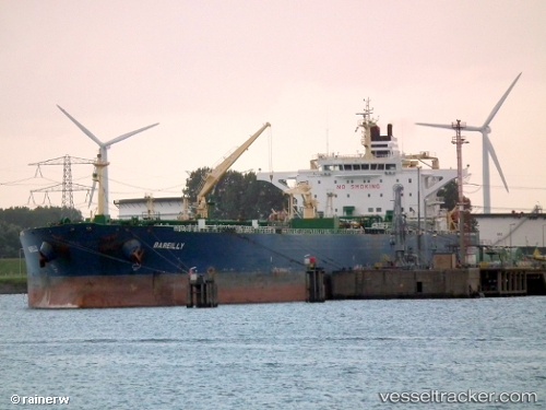
 AQUATICA
Current Status
Where is the vessel?
AQUATICA is currently in 46 nm E of Longyan Pt, based on AIS data received about 1h ago.
Latest AIS update:
Current position: 37.64312° N, 123.55663° E (46 nm E of Longyan Pt)
Average speed (last 7 days): Loading…
Average speed (last 30 days): Loading…
Vessel profile: AQUATICA is a Crude Oil Tanker with dimensions m x m.
This page combines live AIS, route history, probable destination signals, nearby traffic, and port activity for practical vessel monitoring.
The current position of vessel AQUATICA is 37.64312 lat / 123.55663 lng. Updated: 2026-04-07 20:18:25 UTCNearest reference points:
- 34 nm E of Longyan Pt
- 54 nm E of Longyan Pt
- 30 nm E of Longyan Pt
Currently sailing under the flag of Equatorial Guinea ![]()
Details:
Live Vessel AQUATICA Analytics (details, animations, etc.)
Recent AIS points (UTC):
2026-04-07 13:54:43 UTC · 37.64700, 123.55505 · SOG 0 kn · COG 176°2026-04-07 15:30:44 UTC · 37.64675, 123.55544 · SOG 0.1 kn · COG 188°
2026-04-07 18:14:33 UTC · 37.64300, 123.55664 · SOG 0 kn · COG 308°
2026-04-07 20:18:25 UTC · 37.64312, 123.55663 · SOG 0 kn · COG 307°