 vesseltracker.com
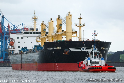
 THEODORE
Current Status
Where is the vessel?
THEODORE is currently in Near TUZLA, based on AIS data received less than 1h ago.
Latest AIS update:
Current position: 40.84323° N, 29.27141° E (Near TUZLA)
Average speed (last 7 days): Loading…
Average speed (last 30 days): Loading…
Vessel profile: THEODORE is a Bulk Carrier with dimensions m x m.
This page combines live AIS, route history, probable destination signals, nearby traffic, and port activity for practical vessel monitoring.
The current position of vessel THEODORE is 40.84323 lat / 29.27141 lng. Updated: 2026-04-21 12:12:31 UTCNearest reference points:
- Near TUZLA
- Near PENDIK
- Near Tuzla Free Zone
Currently sailing under the flag of Barbados ![]()
Details:
Live Vessel THEODORE Analytics (details, animations, etc.)
Recent AIS points (UTC):
2026-04-21 07:32:40 UTC · 40.84315, 29.27136 · SOG 0 kn · COG 218°2026-04-21 08:08:39 UTC · 40.84324, 29.27140 · SOG 0 kn · COG 218°
2026-04-21 09:20:21 UTC · 40.84322, 29.27138 · SOG 0 kn · COG -1°
2026-04-21 12:12:31 UTC · 40.84323, 29.27141 · SOG 0 kn · COG 217°