 vesseltracker.com
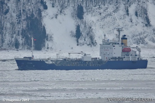
 Juno Marie
Current Status
Where is the vessel?
Juno Marie is currently in Near Longue-Pointe, based on AIS data received less than 1h ago.
Latest AIS update:
Current position: 45.58142° N, 73.50553° W (Near Longue-Pointe)
Average speed (last 7 days): Loading…
Average speed (last 30 days): Loading…
Vessel profile: Juno Marie is a Chemical Oil Products Tanker with dimensions 80m x 14m.
This page combines live AIS, route history, probable destination signals, nearby traffic, and port activity for practical vessel monitoring.
The current position of vessel Juno Marie is 45.58142 lat / -73.50553 lng. Updated: 2026-03-30 03:48:44 UTCNearest reference points:
- Near Longueuil
- Near Montréal-Est
- Near Montreal
Currently sailing under the flag of Canada ![]()
Juno Marie built in 2004 year
Deadweight:
1952 tDetails:
Live Vessel Juno Marie Analytics (details, animations, etc.)
Recent AIS points (UTC):
2026-03-29 21:57:42 UTC · 45.58141, -73.50554 · SOG 0 kn · COG 197°2026-03-29 23:33:45 UTC · 45.58141, -73.50556 · SOG 0 kn · COG 197°
2026-03-30 01:39:47 UTC · 45.58141, -73.50556 · SOG 0 kn · COG 197°
2026-03-30 03:48:44 UTC · 45.58142, -73.50553 · SOG 0 kn · COG 198°