 vesseltracker.com
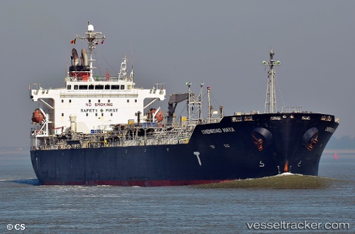
Chemroad Haya
Current StatusWhere is the vessel?
Chemroad Haya is currently in 117 nm W of JAIGAD, based on AIS data received less than 1h ago.
Latest AIS update:
Current position: 17.17757° N, 71.19629° E (117 nm W of JAIGAD)
Average speed (last 7 days): Loading…
Average speed (last 30 days): Loading…
Vessel profile: Chemroad Haya is a Chemical Oil Products Tanker with dimensions 29m x 175m.
This page combines live AIS, route history, probable destination signals, nearby traffic, and port activity for practical vessel monitoring.
The current position of vessel Chemroad Haya is 17.17757 lat / 71.19629 lng. Updated: 2026-04-20 17:01:37 UTCNearest reference points:
- Near JAIGAD
- 49 nm W of Pernem
- 89 nm W of Marmagao (Marmugao)
Details:
Live Vessel Chemroad Haya Analytics (details, animations, etc.)
Recent AIS points (UTC):
2026-04-20 13:28:38 UTC · 16.49460, 71.59219 · SOG 13.5 kn · COG 332°2026-04-20 13:48:18 UTC · 16.55951, 71.55564 · SOG 13.5 kn · COG 332°
2026-04-20 16:07:29 UTC · 17.00540, 71.29464 · SOG 13 kn · COG 330°
2026-04-20 17:01:37 UTC · 17.17757, 71.19629 · SOG 13.3 kn · COG 338°