 vesseltracker.com
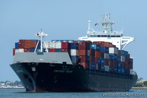
 CHIQUITA EXPLORER
Current Status
Where is the vessel?
CHIQUITA EXPLORER is currently in 56 nm NE of San Andrés, based on AIS data received less than 1h ago.
Latest AIS update:
Current position: 13.30500° N, 81.09833° W (56 nm NE of San Andrés)
Average speed (last 7 days): Loading…
Average speed (last 30 days): Loading…
Vessel profile: CHIQUITA EXPLORER is a Container Ship with dimensions m x m.
This page combines live AIS, route history, probable destination signals, nearby traffic, and port activity for practical vessel monitoring.
The current position of vessel CHIQUITA EXPLORER is 13.30500 lat / -81.09833 lng. Updated: 2026-04-20 04:08:18 UTCCurrently sailing under the flag of Liberia ![]()
Details:
Live Vessel CHIQUITA EXPLORER Analytics (details, animations, etc.)
Recent AIS points (UTC):
2026-04-20 01:14:17 UTC · 12.51167, -80.85167 · SOG 17 kn · COG -1°2026-04-20 01:35:21 UTC · 12.60833, -80.87833 · SOG 17 kn · COG -1°
2026-04-20 03:43:54 UTC · 13.19482, -81.06112 · SOG 17.1 kn · COG 345°
2026-04-20 04:08:18 UTC · 13.30500, -81.09833 · SOG 17 kn · COG -1°