 vesseltracker.com
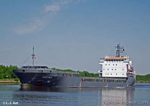
Celina
Current StatusWhere is the vessel?
Celina is currently in Near HIDD, based on AIS data received less than 1h ago.
Latest AIS update:
Current position: 26.20270° N, 50.67064° E (Near HIDD)
Average speed (last 7 days): Loading…
Average speed (last 30 days): Loading…
Vessel profile: Celina is a General Cargo Ship with dimensions 16m x 108m.
This page combines live AIS, route history, probable destination signals, nearby traffic, and port activity for practical vessel monitoring.
The current position of vessel Celina is 26.20270 lat / 50.67064 lng. Updated: 2026-04-01 03:54:00 UTCNearest reference points:
- Near HIDD
- Near Al Hidd
- Near Sitrah Anchorage
Details:
Live Vessel Celina Analytics (details, animations, etc.)
Recent AIS points (UTC):
2026-03-31 21:59:44 UTC · 26.20270, 50.67067 · SOG 0.2 kn · COG -1°2026-04-01 00:11:43 UTC · 26.20265, 50.67068 · SOG 0 kn · COG -1°
2026-04-01 01:38:05 UTC · 26.20267, 50.67066 · SOG 0.5 kn · COG -1°
2026-04-01 03:54:00 UTC · 26.20270, 50.67064 · SOG 0 kn · COG -1°