 vesseltracker.com
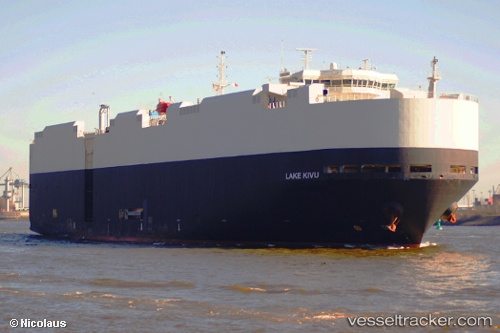
 Lake Kivu
Current Status
Where is the vessel?
Lake Kivu is currently in Near Strait Of Gibraltar, based on AIS data received about 3h ago.
Latest AIS update:
Current position: 35.93285° N, 5.87133° W (Near Strait Of Gibraltar)
Average speed (last 7 days): Loading…
Average speed (last 30 days): Loading…
Vessel profile: Lake Kivu is a Vehicles Carrier with dimensions 182m x 32m.
This page combines live AIS, route history, probable destination signals, nearby traffic, and port activity for practical vessel monitoring.
The current position of vessel Lake Kivu is 35.93285 lat / -5.87133 lng. Updated: 2026-04-23 01:03:44 UTCNearest reference points:
- Near TARIFA
- Near TANGER MED
- Near Algeciras
Currently sailing under the flag of Liberia ![]()
Lake Kivu built in 2006 year
Deadweight:
12322 tDetails:
Live Vessel Lake Kivu Analytics (details, animations, etc.)
Recent AIS points (UTC):
2026-04-22 22:03:40 UTC · 35.92200, -5.34957 · SOG 0.2 kn · COG 263°2026-04-22 22:53:21 UTC · 35.95970, -5.33285 · SOG 7.2 kn · COG 340°
2026-04-22 23:23:50 UTC · 35.99778, -5.40010 · SOG 10.1 kn · COG 262°
2026-04-23 01:03:44 UTC · 35.93285, -5.87133 · SOG 18.1 kn · COG 239°