 vesseltracker.com
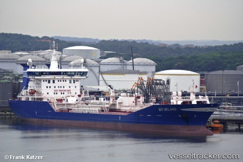
 ELIAH
ELIAH
Current Status
Where is the vessel?
ELIAH is currently in 22 nm SW of JASK, based on AIS data received about 9d ago.
Latest AIS update:
Current position: 25.43038° N, 57.44554° E (22 nm SW of JASK)
Average speed (last 7 days): Loading…
Average speed (last 30 days): Loading…
Vessel profile: ELIAH is a Oil/Chemical Tanker with dimensions m x m.
This page combines live AIS, route history, probable destination signals, nearby traffic, and port activity for practical vessel monitoring.
The current position of vessel ELIAH is 25.43038 lat / 57.44554 lng. Updated: 2026-04-08 10:14:22 UTCNearest reference points:
- 30 nm NE of Offshore Fujairah
- 34 nm NE of Offshore Fujairah
- 42 nm SE of Offshore Fujairah
Currently sailing under the flag of Aruba ![]()
Details:
Live Vessel ELIAH Analytics (details, animations, etc.)
Recent AIS points (UTC):
2026-04-08 09:40:33 UTC · 25.42819, 57.47010 · SOG 4.1 kn · COG 228°2026-04-08 10:14:22 UTC · 25.43038, 57.44554 · SOG 0.7 kn · COG 293°
2026-04-08 10:14:22 UTC · 25.43038, 57.44554 · SOG 0.7 kn · COG 293°
2026-04-08 10:14:22 UTC · 25.43038, 57.44554 · SOG 0.7 kn · COG 293°