 vesseltracker.com
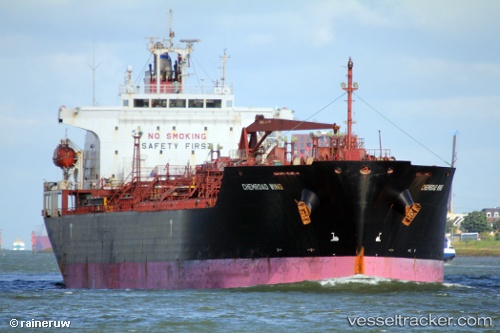
 Chemroad Wing
Current Status
Where is the vessel?
Chemroad Wing is currently in 145 nm SW of Southampton, based on AIS data received about 3h ago.
Latest AIS update:
Current position: 30.70945° N, 67.02240° W (145 nm SW of Southampton)
Average speed (last 7 days): Loading…
Average speed (last 30 days): Loading…
Vessel profile: Chemroad Wing is a Chemical Oil Products Tanker with dimensions 170m x 26m.
This page combines live AIS, route history, probable destination signals, nearby traffic, and port activity for practical vessel monitoring.
The current position of vessel Chemroad Wing is 30.70945 lat / -67.02240 lng. Updated: 2026-04-04 15:35:32 UTCCurrently sailing under the flag of Panama ![]()
Chemroad Wing built in 2005 year
Deadweight:
32051 tDetails:
Live Vessel Chemroad Wing Analytics (details, animations, etc.)
Recent AIS points (UTC):
2026-04-04 10:23:16 UTC · 31.20620, -65.82038 · SOG 13.2 kn · COG 250°2026-04-04 11:50:38 UTC · 31.07110, -66.15036 · SOG 12.7 kn · COG 243°
2026-04-04 13:24:29 UTC · 30.91319, -66.50360 · SOG 13.4 kn · COG 245°
2026-04-04 15:35:32 UTC · 30.70945, -67.02240 · SOG 13.7 kn · COG 241°